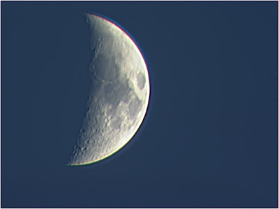
You might think that the best time to observe the moon is when it is at it's brightest - during the full moon. Actually, that's probably the worst time to see the moon. When the moon is full, it tends to be dazzlingly bright as well as flat and one-dimensional in appearance. All the detail of craters, mountains and valleys will be completely washed out by the dazzling light. In contrast, the interval when the moon is at or just past first quarter phase, or at or just before last quarter phase, is when we get the best views of the lunar landscape - and the best views can be seen right along the sunrise-sunset line, or terminator - the line between the illuminated portion and the part of the moon in shadow.)
Let's start with this image of the northern pole of the moon below.
You'll see a few small, round craters, such as Democritus and Galle. Democritus is only about 25 miles in diameter, while Galle is about 21 km wide. Both craters are nearly circular, with sharp-edged rims and little appearance of erosion. They are located in a wide plain known as Mare Frigoris (the "Sea of Cold"). However, southeast of Galle, in the shadow of the terminator, you will just about see a much larger crater, Aristoteles. This crater is 87 km in diameter and the small crater on the right immediately under Aristoteles is Mitchell. An arc of mountains separate these craters.
Head a little further south in the northern hemisphere and you'll see two very interesting craters below.
Ritter, at the bottom of the image above, is a lunar crater located near the southwestern edge of Mare Tranquillitatis (Sea of Tranquility). It is the northwestern member of a crater pair with Sabine to the southeast. The two rims are separated by a narrow valley only a couple of kilometers wide. The Sea of Tranquility is actually quite special because it was the landing site for the first manned landing on the Moon - the area just to the east of Ritter and Sabine. After making a smooth touchdown in the Apollo 11 Lunar Module named Eagle, astronaut Neil Armstrong told flight controllers on Earth, "Houston, Tranquility Base here. The Eagle has landed."
Another interesting feature in the image above is Plinius - a prominent lunar impact crater on the border between Mare Serenitatis (Sea of Serenity) to the north and Sea of Tranquility to the south. If you look carefully at this crater, you might be able to make out a central peak right in the middle of the crater floor. This centrla peak is more evident in the zoomed image of Plinius below.
How was this central peak formed? Well, if you drop something into a pool of water, you will get a rebound effect in the middle where the object was dropped, and then waves will spread out around it. This rebound effect in the middle is the same phenomenon that causes central peaks in craters. the central peaks are formed by rock rebounding, being pushed back up by the strength of the underlying rock after the initial impact event. An impact that forms a crater on the moon that is greater than 15km will cause the rock to act like the liquid to the point that you get the rebound effect and form a central peak. Smaller craters will not have central peaks, and larger craters above 120 km will form a ring of peaks. Central peak formation happens within minutes of the impact itself.
Head further south into the southern hemisphere and you will more clearly see more of these central peaks in the image below.
Theophilus is a prominent lunar impact crater that lies between Sinus Asperitatis (Bay of Roughness) in the north and Mare Nectaris (Sea of Nectar) to the southeast. It partially intrudes into the comparably sized crater Cyrillus to the southwest. To the east is the smaller crater Mädler. The floor of the Theophilus is relatively flat, and it has a large, imposing central peak which is 1,400 meters high.
And as you head to the southern pole, you'll see the basalt plains make way for more rugged highlands that are pock-marked by hundreds of craters - indicating that this part of the moon once endured some heavy battering at one time in the very distant past.
All photographs on this page © Sabri Zain 2012.


